The Homestead of Francis Thurtell
and His Family
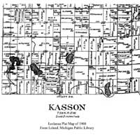
Francis Thurtell purchased 25.35 acres in Michigan on July 1, 1869, in Section 28, Township 28 North, Range 13 West, of the Michigan Principal Meridian (Volume 2420, Page 189, Document 3616, Aliquot Part Reference 4). He obtained an additional 160.00 acres on February 10, 1873, as a Homestead Entry located in Section 28, Township 28 North, Range 13 West. of the Michigan Principal Meridian (Volume 2480, Page 403, Document 900, Aliquot Part Reference SE, Miscellaneous Document Number 1554).
Francis Thurtell and his family settled on this farm in Leelanau County Michigan, and were living there as of the 1880 U.S. Census. Prior to 1900 the family moved to Traverse City, Michigan, but apparently still owned the original property for some time after that.
Their property according to maps obtained from the library in Leland, Michigan, was right next to Route 72 at the point where this east-west route turns north when traveling east from Traverse City to Empire, Michigan.
As can be seen on the map on the left, the property of Reverend Joshua B. Hall was just south of the Thurtell property.
 |
 |
Click on any of the images on this page for a larger view.
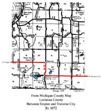
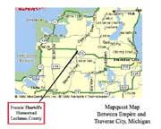
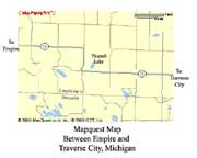
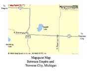
The maps below center in on the area that had been the homestead property of Francis Thurtell and his family. The easiest landmark is what was then called Thurtell Lake, the shape of which can be identified on the old maps above as well as the current maps below. On more recent maps this lake has been called Turtle Lake and more recently Polack Lake.
 |
 |
 |
Click on any of the images on this page for a larger view.

 Links to other sites on the Web
Family
Group Page for Francis and Amelia Higginson Thurtell
View Pictures
of Francis and Amelia Higginson Thurtell with More Information
More Information
about Francis Thurtell
More Information
about Amelia Higginson Thurtell
Susan T.
Miller's Genealogy Home Page
Index
to Susan T. Miller's Genealogy Pages with Photographs
Grand Traverse
County, Michigan, Web Pages
Records of the Bureau of Land
Management, Eastern Division, with a Searchable Index
This page was last updated November 20, 2000.
© 2000